
August 1, 2022 – esri, a provider of geographic information system (GIS) software, location intelligence, and mapping solutions, recently announced the release of the ArcGIS Maps SDK for Unity and the ArcGIS Maps SDK for Unreal Engine. Both SDKs provide direct ArcGIS integration to developers working with these game engines.
According to Esri, in recent years, technologies originally developed to create gaming experiences have evolved into robust, real-time 3D development tools that span a wide range of industries. Developers are using these tools to create entirely new classes of applications. Sometimes referred to as serious games or immersive experiences, these sophisticated, realistic, intuitive, and engaging visual approaches to working with real-world data are taking off, exposing value in existing data sets that might previously have been difficult to harness.
The company stated that in response to customer feedback and to make it easier to work with real-world data in game engines, Esri began work on two ArcGIS Maps SDKs in 2019 with the goal of providing a premium set of tools for developers who can bring ArcGIS data directly into game engine development environments.
Now at version 1.0, both SDKs will enable developers to leverage accurate real-world data and rich geospatial analytics, on a global or local scale, in their applications and projects. Developers will benefit from the accuracy and authenticity provided by real-world geospatial data, whether it is their own existing organizational data or live services from repositories such as the ArcGIS Living Atlas of the World.
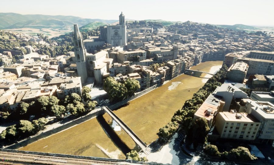

With the new SDKs, developers can create augmented reality (AR), tabletop AR, and virtual reality (VR) experiences on a global scale for industries such as Architecture, Engineering, and Construction (AEC), defense, public safety, natural resources, and urban planning.
Specific use cases in these industries could include:
- AEC Organizations – you can use game engines to render construction sites in real time for decision makers to review without having to be on the site themselves;
- Defending – for simulation of troop movements, various scenarios, and mission planning;
- Public Safety Organizations – you can model crowd control at major events and explore how positioning staff in different configurations could change the flow of crowds to and from an event;
- Natural resource companies – you can use game engines to better manage existing infrastructure and socialize/communicate innovations in power generation, such as visualizing a proposed solar or wind farm and its impact on the landscape;
- urban planners – they can conduct collaborative planning and explore what proposed developments will look and feel like in the real-world context of their communities.
Esri added that both CIMIC Group Y Houseal Lavigne have recently shared how their organizations are using the respective SDKs to create immersive renderings of the projects they are supporting.
the ArcGIS Maps SDK for Unity and the ArcGIS Maps SDK for Unreal Engine provide a foundation for consuming ArcGIS content and integrating with the ArcGIS system. Both SDKs are now available as free downloads for users with a free ArcGIS developer account or an ArcGIS Online account.
To learn more about the ArcGIS Maps SDK for Unity and the ArcGIS Maps SDK for Unreal Engine, and their applications for creating AR and VR experiences, you can find a detailed and detailed explanation of the solutions in the ArcGIS Blog.
Image/Video Credit: Esri/ArcGIS/YouTube
sam sprigg
Sam is the founder and managing editor of Auganix. With a background in research and report writing, he has been covering XR industry news for the past five years.